Travel with Billy Carson —
 Çatalhöyük (also written Catalhoyuk or Çatal Hüyük) is a large Neolithic and Chalcolithic settlement on the Konya Plain of south-central Turkey, occupied from roughly 7400 to 5200 BCE according to UNESCO's dating. It is known for mudbrick houses packed wall to wall with no streets, entered through the roof by ladder, with the dead buried under the floors and the walls covered in paintings, plaster reliefs and mounted cattle horns.
The site matters because it is one of the largest and best-preserved early farming communities ever excavated, and because three of its finds became famous far beyond archaeology: the roof-entry houses, the clay figurine known as the Seated Woman, and a wall painting often described as the world's oldest map. Each of those has a popular story attached to it, and each has been tested by more than sixty years of digging. This guide sets out what the evidence supports, where specialists still disagree, and where Çatalhöyük fits in the long story of Anatolia.
Where is Çatalhöyük and how old is it?
Çatalhöyük lies on the Konya Plain in central Anatolia, south-east of the modern city of Konya, and consists of two mounds that rise up to about 20 metres above the plain. UNESCO inscribed the "Neolithic Site of Çatalhöyük" on the World Heritage List in 2012 under criteria (iii) and (iv), recognising it as an exceptional record of early settled life.
The East Mound is the older and taller of the two. It holds 18 levels of Neolithic occupation, which UNESCO dates to about 7400–6200 BCE. The West Mound continues the story into the Chalcolithic, the early copper-using age, at about 6200–5200 BCE. Popular summaries often quote a narrower span such as "c. 7100–5700 BCE"; dates vary by source and by the radiocarbon models used, so the UNESCO ranges are the safest reference.
In the wider sequence, Çatalhöyük comes after the great hunter-gatherer enclosures of south-eastern Turkey. Göbekli Tepe was begun around 9500 BCE, and the related sites of the Taş Tepeler, including Karahan Tepe, belong to the same early world of carved pillars and ritual buildings. Çatalhöyük belongs to the next chapter: a village of farmers and herders living year-round in one place. The ancient civilizations timeline places it squarely in that farming-village phase, thousands of years before the first cities of Sumer.
Who excavated Çatalhöyük?
British archaeologist James Mellaart identified the site in 1958 during a survey of the Konya Plain and excavated it over four seasons between 1961 and 1965. In that short window his team exposed a large area of the East Mound and recovered most of the famous paintings and reliefs, which he published in his 1967 book Çatal Hüyük: A Neolithic Town in Anatolia. His work stopped after 1965, and the site lay largely untouched for almost three decades.
In 1993 Ian Hodder reopened Çatalhöyük with the Çatalhöyük Research Project, based first at Cambridge and later at Stanford. It became one of the most heavily documented excavations anywhere, with an international team of specialists in plants, animal bone, human remains, soils and dating, and with detailed archive reports published season by season. Hodder's project ran until 2018. Excavation has continued since under Turkish direction, led by Ali Umut Türkcan of Anadolu University, alongside other teams working on parts of the mounds.
The two eras of excavation produced different pictures of the site. Mellaart worked fast over a wide area and offered bold interpretations. Hodder's team dug slowly, sieved and sampled everything, and tested those interpretations against a much larger body of evidence. Most of the debates below come from that contrast.
How did people live in the roof-entry houses?
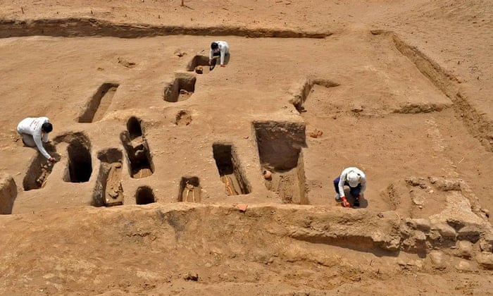
People at Çatalhöyük lived in rectangular mudbrick houses built directly against one another, with no streets or alleys between them. The flat roofs served as the walkways of the settlement. To get into a house, people climbed down a wooden ladder through an opening in the roof, which also let out the smoke from the oven and hearth. UNESCO's description of the site singles out this streetless layout, with houses "clustered back to back with roof access."
Inside, a typical house had a main room with plastered floors and walls, raised platforms for sitting, working and sleeping, a hearth and oven, and small side rooms for storage reached through low openings. Houses were kept remarkably clean, with rubbish dumped in middens outside rather than left indoors. When a house reached the end of its life, it was carefully dismantled, filled in and a new house was built on the same footprint, sometimes repeating the same layout over many generations. That habit of rebuilding in place is one reason the East Mound grew so tall.
The dead were buried beneath the floors of these houses, especially under the platforms and hearths. Bodies were usually tightly flexed, and some were wrapped or placed in baskets. A small number of skulls were removed and later plastered and painted with ochre. Living families slept, cooked and worked directly above their ancestors, which suggests that the house was a place of memory and belonging as well as a shelter.
What do the wall paintings and bull horns show?
The interiors of many buildings carried paintings, plaster reliefs and installations that make Çatalhöyük one of the richest sources of Neolithic art. Among the best known are scenes of vultures hovering over headless human figures, large red aurochs (wild cattle) and deer surrounded by small human figures, and hunting or teasing scenes. Reliefs include pairs of facing animals, often read as leopards or lionesses, and walls and benches were set with the plastered horns of wild cattle.
Mellaart called the most richly decorated rooms "shrines" and treated them as temples. Hodder's team found that the line between shrine and house is blurry: decorated buildings were also lived in, with ovens, storage and burials, and many seem to have been especially important houses rather than separate temples. The current view is that ritual and daily life happened in the same rooms. The vulture paintings are often linked to how the community thought about death, though what they meant to the people who painted them is still a matter of interpretation.
How many people lived at Çatalhöyük?
Population estimates for Çatalhöyük have fallen sharply as excavation has improved. Early figures often put the settlement at 5,000 to 7,000 people, with some estimates as high as 10,000, which helped fuel the idea of a Stone Age "city." Those figures assumed that most of the buildings on the mound were standing and occupied at the same time.
Newer work tests that assumption house by house. A 2024 study by Ian Kuijt and Arkadiusz Marciniak in the Journal of Anthropological Archaeology estimated a peak of roughly 600 to 800 people in an average year during the Middle phase, around 6700–6500 BCE. Every estimate depends on how many houses are assumed to have been in use at the same time, so the honest answer is a range rather than one figure. Either way, Çatalhöyük is best described as one of the largest and best-preserved Neolithic settlements known. Whether it deserves the word "city" at all is debated, and it is not the oldest city in the world.
The Seated Woman and the mother-goddess debate
The Seated Woman of Çatalhöyük is a baked-clay figurine about 17 cm long, showing a heavy woman seated between two armrests shaped like big cats. Mellaart found it in 1961 and reported it from a grain bin. It dates to about 6000 BCE and is now displayed in the Museum of Anatolian Civilizations in Ankara. One detail is often missed: the head and one of the feline armrests were missing when it was found and are modern replacements, so the face seen in photographs is not original.
Mellaart read the figure as a mother goddess giving birth on a throne, and he built a wider theory of a goddess cult at the heart of Çatalhöyük religion. That reading travelled far, influencing popular books and the modern goddess movement. Hodder's project tested it against far more material and found little support. Lynn Meskell, who studied the figurines, noted that of roughly 2,000 figurines from the site, fewer than 5 percent clearly depict women; most show animals or are too schematic to identify.
In 2016 the Hodder team announced a rare intact female figurine of recrystallised limestone, about 17 cm long and about 1 kg in weight, dated to between 6300 and 6000 BCE. Hodder and Meskell suggested that figures like this may honour older women who had achieved high status in the community rather than a single goddess. A mother-goddess religion at Çatalhöyük is therefore a hypothesis, not an established fact, and the figurines are better read as one part of a varied symbolic world.
Is the Çatalhöyük mural really the oldest map?
A wall painting found by Mellaart is often called the world's oldest map. It shows a grid of rectangles that many read as the houses of the settlement, with a shape above it read as a twin-peaked volcano, usually identified as Hasan Dağı, which is visible from the Konya Plain. The painting is usually dated to about 6600 BCE.
Geology lent the volcano reading some support. A 2014 study in PLOS ONE led by Axel Schmitt of UCLA dated an explosive eruption of Hasan Dağı to about 8,900 years ago, roughly 6900 BCE. That is close to the estimated age of the painting, which means the people of Çatalhöyük could have seen or remembered an eruption.
Not everyone accepts that the image is a map at all. Stephanie Meece, in a 2006 paper in Anatolian Studies, argued that the "volcano" is more convincingly a spotted leopard skin, placed above a geometric pattern of the kind found elsewhere at the site, and that the grid need not depict the village. Both readings remain in play. The painting may be a landscape with a volcano, a leopard skin over a decorative panel, or something that does not map neatly onto either category.
For comparison, the engravings of desert kites from Jordan and Saudi Arabia, published in PLOS ONE in 2023 by Rémy Crassard and colleagues, are described by their authors as the oldest known plans drawn to scale, at roughly 9,000 and 8,000 years old. The 4biddenknowledge archive covered that find in the oldest architectural plans ever discovered. Those engravings show specific structures in measured proportion, which is a different claim from a painted townscape.
Billy Carson's reading
Billy Carson has not published a dedicated video or episode on Çatalhöyük, so this article does not attribute a specific position on the site to him. The settlement does sit inside the larger questions his work keeps returning to: how early Anatolian communities moved from hunter-gatherer monuments to farming villages, and what the region's oldest sites say about the origins of civilisation.
Those questions run through his network's coverage of the Anatolian sites that came before Çatalhöyük: Göbekli Tepe and the Taş Tepeler, which his network has discussed with researcher Andrew Collins and which the companion guides linked above cover in detail. Elsewhere in central Anatolia, the Derinkuyu guide covers another Anatolian site, where Carson reads the underground refuges of Cappadocia as part of a global human response to ancient cataclysm. Readers who want his broader framework for early civilisation and the Sumerian accounts that follow can start at the Anunnaki topic hub.
Watch, read and go deeper
On 4BK TV, the Megalithic Mysteries series explores Anatolian and megalithic sites and the open questions around who built them. The ancient civilizations timeline shows where Çatalhöyük sits between Göbekli Tepe and the first cities of Mesopotamia, and where the lost-civilisation debate fits. The Anunnaki topic hub gathers Billy Carson's articles and episodes on ancient origins.
Frequently asked questions
Is Çatalhöyük the oldest city in the world?
No. Çatalhöyük is one of the largest and best-preserved Neolithic settlements known, but older settled sites exist, and whether it was a "city" at all is debated. Its population was probably far smaller than early estimates, and it shows little sign of the public buildings or marked social ranking usually associated with cities.
Why did people enter Çatalhöyük houses through the roof?
The houses were built wall to wall with no streets, so the flat roofs served as the walkways and the roof opening was the main way in. The opening also let out smoke from the oven and hearth. Why the community chose this layout is still an open question.
Is the Seated Woman of Çatalhöyük a goddess?
Her excavator, James Mellaart, read her as a mother goddess, but that remains an interpretation. Later excavations found that fewer than 5 percent of the site's roughly 2,000 figurines clearly depict women, and some researchers suggest such figures honour respected older women. Her head and one armrest are modern replacements.
Does the Çatalhöyük map mural show a volcano?
It might. A 2014 study dated an eruption of Hasan Dağı to about 6900 BCE, close to the painting's estimated date, which supports the volcano reading. Other scholars argue the image is a leopard skin above a geometric pattern, and neither reading has been proven.
Can you visit Çatalhöyük?
Yes. The site near Konya is open to visitors, with protective shelters over the excavation areas and a visitor centre. Many of the most famous finds, including the Seated Woman, are displayed at the Museum of Anatolian Civilizations in Ankara.
Sources and further reading
- UNESCO World Heritage Centre, "Neolithic Site of Çatalhöyük," inscribed 2012.
- James Mellaart, Çatal Hüyük: A Neolithic Town in Anatolia (Thames and Hudson, 1967).
- Ian Hodder, The Leopard's Tale: Revealing the Mysteries of Çatalhöyük (Thames and Hudson, 2006).
- Axel K. Schmitt and colleagues, "Identifying the Volcanic Eruption Depicted in a Neolithic Painting at Çatalhöyük, Central Anatolia, Turkey," PLOS ONE (2014).
- Stephanie Meece, "A bird's eye view – of a leopard's spots: The Çatalhöyük 'map' and the development of cartographic representation in prehistory," Anatolian Studies (2006).
- Ian Kuijt and Arkadiusz Marciniak, population study of Neolithic Çatalhöyük, Journal of Anthropological Archaeology (2024).
- Rémy Crassard and colleagues, "The oldest plans to scale of humanmade mega-structures," PLOS ONE (2023).